
Our Drones

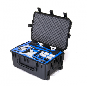
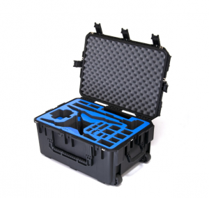
DJI Phantom 4 RTK
October 30, 2018
Mavic 2 Enterprise (Zoom) Universal Edition
October 31, 2018")


")
")
")
")
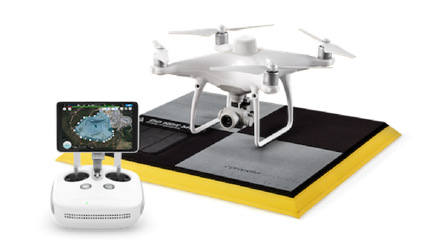
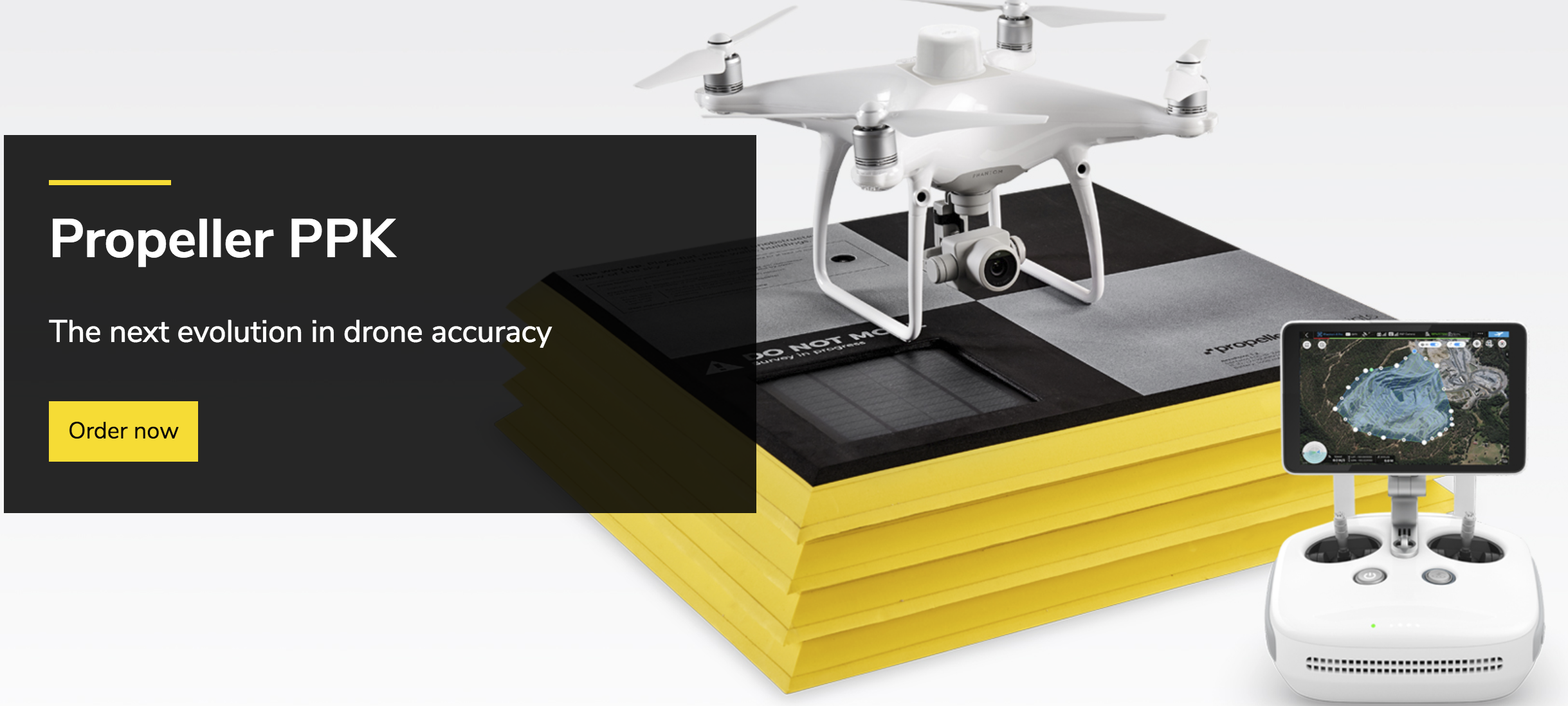
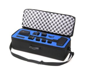
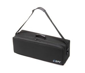
Propeller PPK Combo
Using DJI’s new high-precision Phantom 4 RTK drone, you drone will be equipped with a GPS unit that delivers 1⁄10ft (3cm) accuracy with the reliability of post-processed data.
Pre-Order Only at this time
DOES NOT Include D-RTK 2 Mobile Station
Propeller PPK Solution which leverages the DJI Phantom 4 RTK drone.
Using DJI’s new high-precision Phantom 4 RTK drone, you drone will be equipped with a GPS unit that delivers 1⁄10ft (3cm) accuracy with the reliability of post-processed data.
Next Generation Mapping
DJI has reimagined its drone technology from the ground-up, transforming its solutions to attain a new standard from drone mapping accuracy. This process has resulted in the Phantom 4 RTK, which offers centimeter-accurate data, while requiring less ground control points.
Forget complex surveying equipment and prevent human error with an AeroPoint. A rugged, lightweight ground verification point with one-button operation. Just lay one out near your takeoff point, and they’ll do their job.

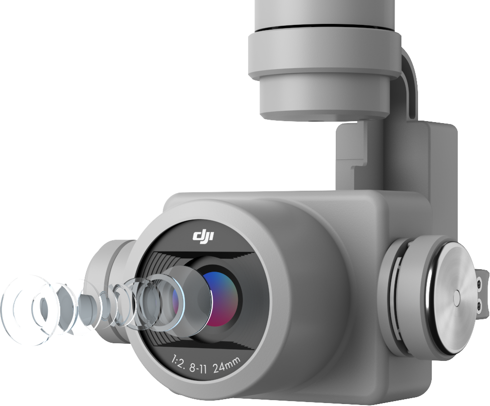
Centimeter level positioning system
The Phantom 4 RTK mapping drone features an all new RTK module that is integrated directly into the drone. This integration provides real-time centimeter-level positioning data, providing for improved absolute accuracy written to the image metadata. Just beneath the RTK receiver is the standard and redundant GNSS GPS Module, this is included to provide slight stability in regions with poor GPS signal such as dense cities. Combining both of these modules, the Phantom 4 RTK is able to enhance flight safety while ensuring that the most precise data is obtained for complex surveying, mapping and inspection workflows.
Fit the Phantom 4 RTK to any workflow, with the ability to connect this positioning system to the D-RTK 2 Mobile Station, NTRIP (Network Transport of RTCM via Internet Protocol) using a 4G dongle or WiFi hotspot, or store the satellite observation data to be used for Post Processed Kinematics (PPK).
The Propeller PPK Combo utilizes the Phantom 4 RTK drone combined with a single Propeller AeroPoint to provide the ultimate PPK Drone Mapping Solution.
Gather Accurate Data with TimeSync
To take full advantage of the Phantom 4 RTK’s positioning modules, the new TimeSync system was created to continually align the flight controller, camera and RTK module.
Additionally, TimeSync ensures each photo uses the most accurate metadata and fixes the positioning data to the center of the CMOS – optimizing the results from photogrammetric methods and letting the image achieve centimeter-level positioning data.
Precise Imaging System
The Phantom 4 RTK provides the best possible image data by utilizing a 1-inch 20 megapixel CMOS sensor as well as mechanical shutter that reduces the effects of rolling shutter significantly. Utilizing the 20 megapixel CMOS sensor the Phantom 4 RTK can achieve a Ground Sample Distance (GSD) of 2.74 cm at 100 meters flight altitude.
To ensure each Phantom 4 RTK offers unparalleled accuracy, every single camera lens goes through a rigorous calibration process where radial and tangential lens distortions are measured. The distortion parameters gathered are saved into each image’s metadata, letting post-processing software adjust uniquely for every user.
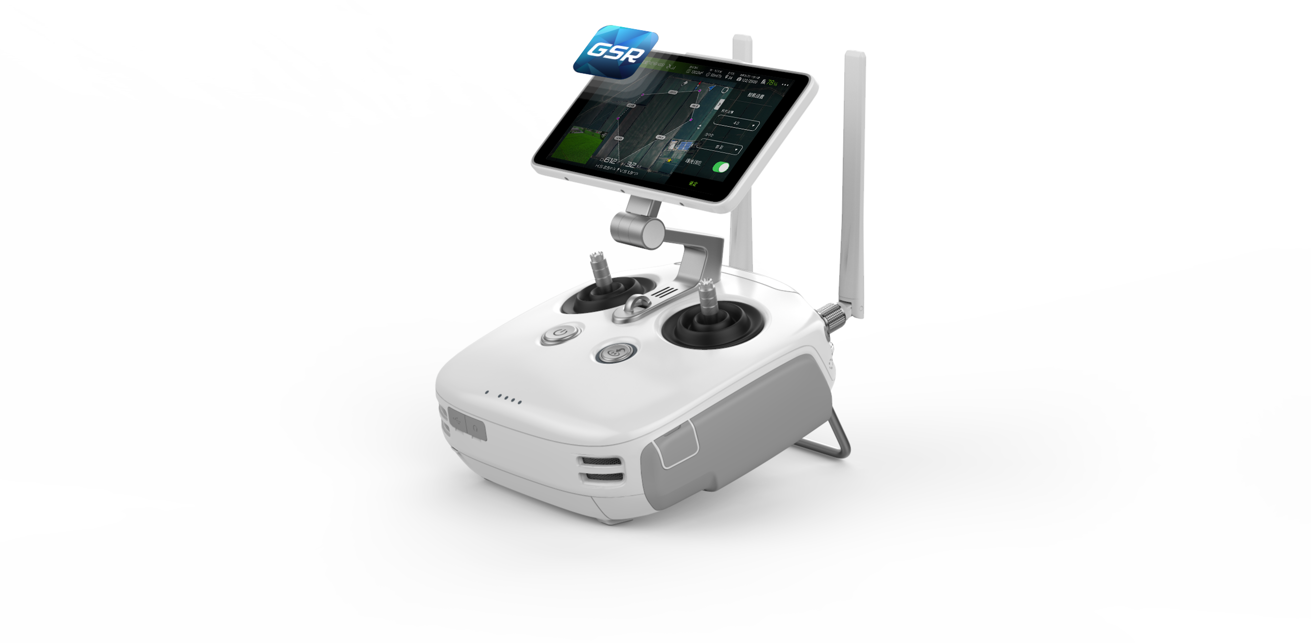
Purpose-Built Flight Planning Application
A new GS RTK app allows pilots to intelligently control their Phantom 4 RTK, with two flight planning modes – Photogrammetry and Waypoint Flight – alongside a more traditional flight mode. The planning modes let pilots select the drone’s flight path while adjusting overlap rate, altitude, speed, camera parameters and more, offering an automated mapping or inspection workflow.
The GS RTK app has been built with its users in mind and therefore has a range of features built for specific mapping or inspection workflows. The app has implemented direct loading of KML/KMZ files for in-office flight planning, an all new shutter priority mode to maintain exposure across all photos and a strong wind alarm to warn pilots of adverse flight conditions.
 Mobile SDK Supported
The Phantom 4 RTK is compatible with the DJI Mobile SDK, opening up its functions to automation and customization through a mobile device.
OcuSync Transmission System
Enjoy stable and reliable HD image and video transmission at distances of up to 7 km, great for mapping larger sites.
*Unobstructed, free of interference, when FCC compliant. Maximum flight range specification is a proxy for radio link strength and resilience. Always fly your drone within visual line of sight unless otherwise permitted.
Optional Propeller AeroPoint Bundle With Single AeroPoint
The Phantom 4 RTK is available without the D-RTK 2 Mobile Base Station and can be used with a Single Propeller AeroPoint
Start Mapping Today
With a built-in flight planning app (GS RTK) and an easy method to collect RTK data (RTK Network or D-RTK 2 Mobile Station), pilots have a full solution for any surveying, mapping or inspection workflow – right out of the box.
Stop slogging through the complex process of aftermarket PPK solutions and use Propeller’s streamlined processing—just one upload of your drone data and you’re on your way to highly accurate drone data.
| Weight | 15 lbs |
|---|---|
| Dimensions | 16 × 16 × 10 in |
Only logged in customers who have purchased this product may leave a review.
Related products
- Add to cart
- Read more
Out of stock
- Read more
Out of stock


Reviews
There are no reviews yet.