DJI Guidance – Visual Sensing System
The New DJI Matrice 100 Quadcopter
May 25, 2015Difference between Phantom 3 Standard, Phantom 3 Professional and Phantom 3 Advanced:
August 5, 2015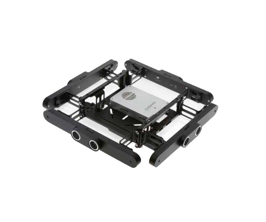
Introducing DJI Guidance. This new platform allows users to gain a new level of protection and safety. The DJI Guidance system includes five sensor modules and one central processor. Users can now have a greater sense of confidence in flight with the combination of these components.
Starting at $999.00

Feature
High‐Precision Vision Positioning
With precision stereo algorithms the DJI Guidance allows a drone to hover precisely and accurately when flying at high speeds. Hovering capabilities are more accurate than ever, even without GPS. Positioning information is available over most terrain. Guidance’s vision positioning system is effective at altitudes of up to 65 feet (20 meters).
Obstacle Sensing in Every Direction
Obstacle avoidance has now reached a new level. Guidance uses various sensing and positioning modules to scan the environment and detects obstacles in real time. Avoiding collision is now an automated process when using a DJI flight controller. When using a DJI flight controller, such as the new N1 on the DJI Matrice 100, the flight system can automatically avoid collision, even at high speeds.
SDK
Using SDK developers can now create customized applications and use the DJI Guidance to expand it’s uses with visual and ultrasonic sensors to cater to a number of drones on the market.
Compatible Flight Platforms
Guidance is fully compatible with the DJI Matrice 100 flight platforms.
Data Interface Ports:
- USB
- Export velocity data, obstacle distance data, IMU data, ultrasonic data, grey‐scale images, and depth images.
- UART
- Export velocity data, obstacle distance data, IMU data, and ultrasonic data.
Supported Data Output:
- Velocity Data
Support for aircraft velocity information output. - Obstacle Distance Data
Obstacle distance data from all five sensors. - IMU Data
Support for IMU data output, including acceleration, attitude data, etc. - Ultrasonic Data
Support for ultrasonic data output from all five sensors. - Grey‐scale Image
Support for grey‐scale image output from all five sensors. - Depth Image
Support for dense depth image output from all five sensors.